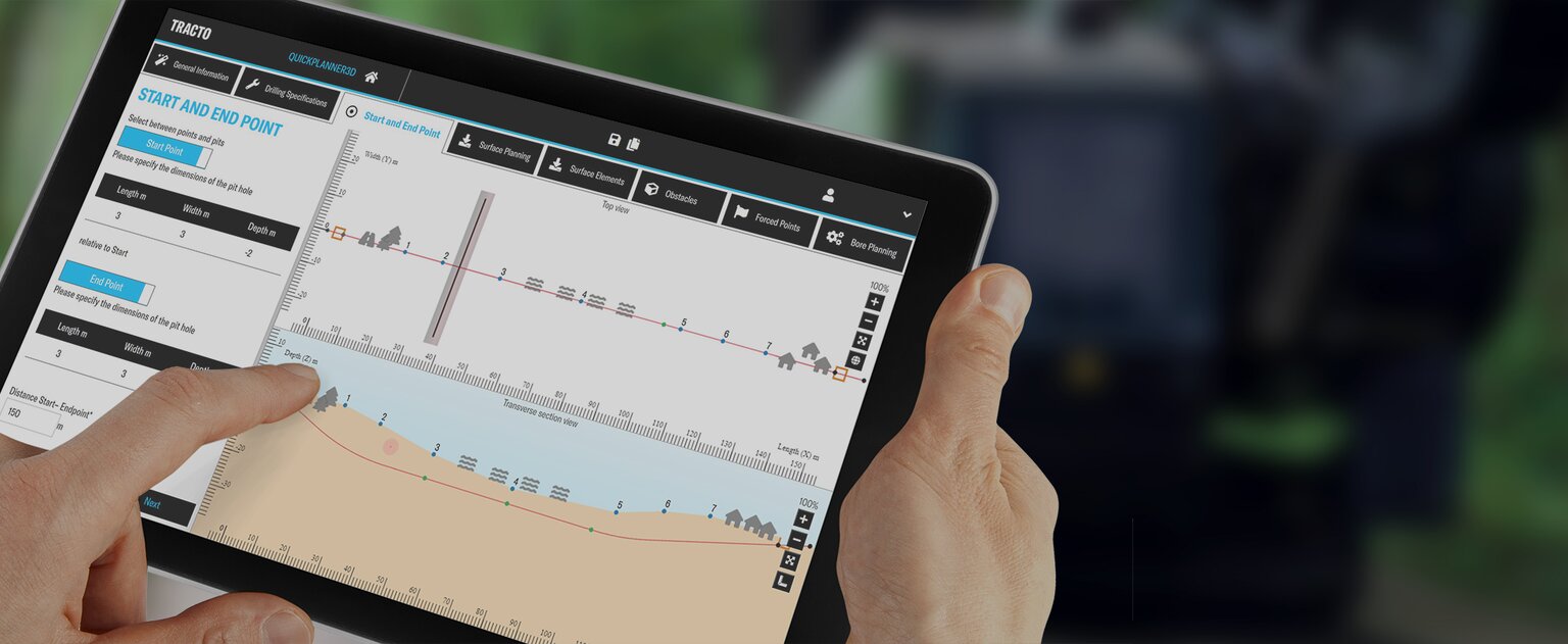
QuickPlanner3D
THE SMART TOOL FOR HDD BORE PLANNING
Accurate planning of the bore path is the basis of any successful HDD project. With commercially available planning tools, checking or calculating the optimum bore path is usually inaccurate, complicated or costly. For complex bores, the limits are quickly reached and often the only option is a tedious manual calculation. QUICKPLANNER3D takes care of these tasks quickly, accurately and reliably.
The app calculates the optimum drill path in seconds, taking into account all relevant factors. Data can be selected from stored calculations, modified at any time and displayed graphically. And the best thing about QUICKPLANNER3D is that it can be used for route planning regardless of the make of drilling rig.
Whether you're looking for a quick and cost-effective feasibility check, precise planning and flexible recalculation, or three-dimensional visualisation of even complex drilling routes - QUICKPLANNER3D makes it easier than you think. The tool can be used without installation on any PC or laptop with internet access. The Wizard digital assistant and user-friendly interface make it easy and intuitive for even inexperienced users to get started with accurate bore planning.
QUICKPLANNER3D AT A GLANCE
The app takes you through the bore planning process step-by-step, automatically gathering all the relevant information.THE WIZARD
Using the digital assistant, you can quickly and easily: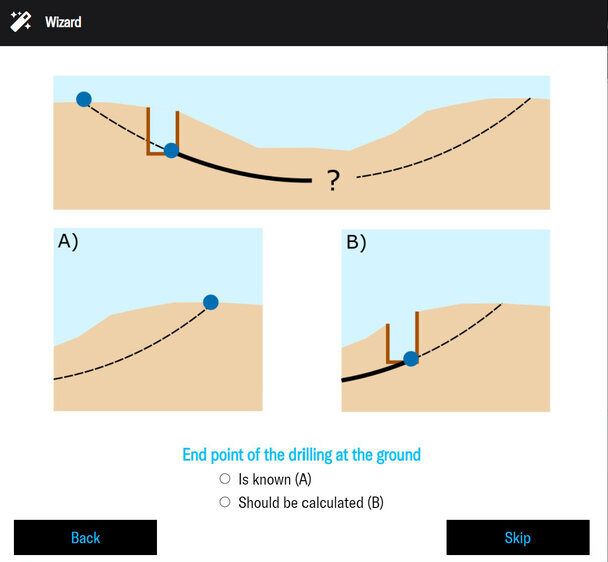
- Create as many bore paths (jobs) as you like or access existing ones
- Define the key data of the job, e. g. machine location, address, date
- Define the start and end points of the bore, such as pit, surface, etc.
ROUTE PLANNING
First, the basic data of the route and the drilling rig are recorded: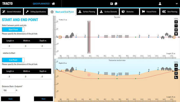
- Distance from start to end point, pit size, entry/exit angle (optional)
- Minimum permissible rod bend radius and product pipe bend radiusBiegeradius
- Manufacturer independent, freely selectable drill rod length
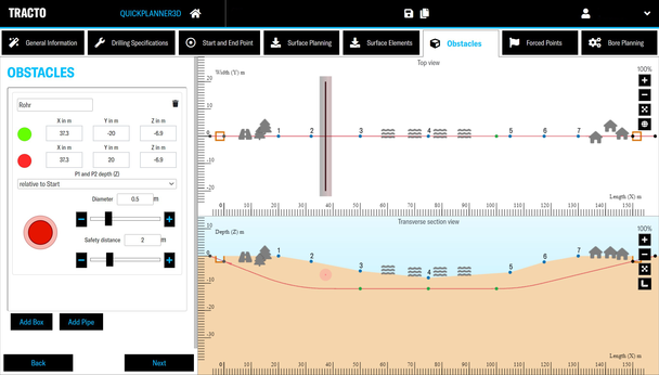
- Graphical and tabular representation of the topography
- Easy moving or inserting of obstacles, constraint points and topography points
- Definition of safety zones around obstacles possible
BORE PLANNING
With a single click, the optimum bore path is automatically calculated from the data entered:- Individual elements or entries can still be modified
- Recalculating or overwriting of previous versions
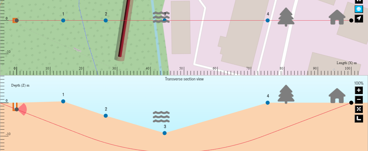
- Representation in tabular or graphic mapping as top view or cross-section
Test QUICKPLANNER3D now for 4 weeks free of charge! The paid subscription is available for only 656, - € per year.
